

Lot n° 91 | Auction 649
Estimate € 3,000 - 5,000
Sold € 11,000
Auction: 27 February 2024 at 15:00
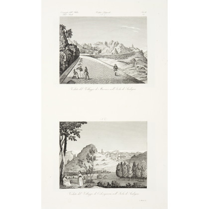
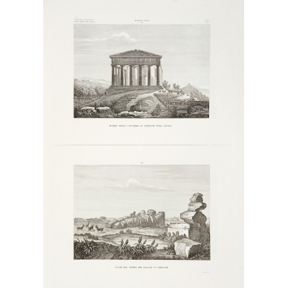
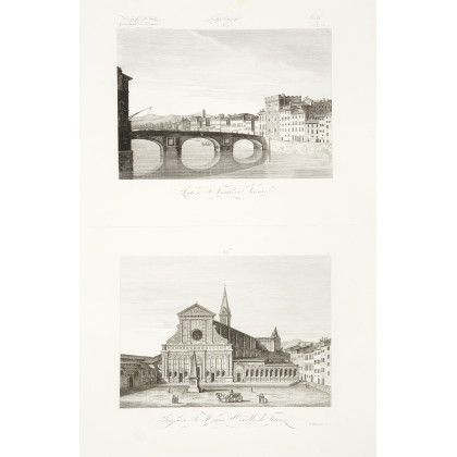
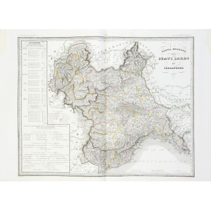
ZUCCAGNI-ORLANDINI, Attilio (1784-1872) - Atlante geografico degli stati italiani delineato sopra le migliori e più moderne mappe per servire di corredo alla Corografia fisica storica e statistica dell’Italia. [INSIEME A:] - Atlante illustrativo, ossia Raccolta dei principali monumenti italiani antichi, del medio evo e moderni e di alcune vedute pittoriche per servire di corredo alla Corografia fisica storica e statistica dell'Italia. Florence: [Società Editrice], 1844. First edition in five volumes comprising the Geographical Atlas in two volumes with 144 engraved maps and plans (67 and 77 respectively), and the Illustrative Atlas in three volumes with 269 magnificent plates with numerous engraved views (91, 92 and 86 respectively). The copy is complete with all 413 plates called for in the indexes present in each volume. The maps of the Geographical Atlas are of great geographical interest and the countless plates of the illustrative Atlas are splendidly engraved with particular attention to the Sardinian States, the Kingdom of Lombardy-Veneto, the Duchies of Parma and Lucca, the Este States, Tuscany, the Papal State and the Kingdom of the Two Sicilies; the final volume in particular is entirely dedicated to the latter. 5 volumes, elephant folio (607 x 435mm). Title and index in each volume, first volume of each part with Avvertenze (some dampstaining especially in the margins of the first volume, small tears on some titles, some maps of the first volume loose). Contemporary half calf over dark pink decorated paper (somewhat worn). Provenance: blindstamped monogram on maps. (5)
Estimate € 3,000 - 5,000